Israel expands territorial footprint under Netanyahu war strategy
Israel now controls roughly 1,000 square kilometres across Gaza, southern Lebanon and Syria, turning buffer zones into a regional strategy with rising diplomatic costs.
Israel has seized roughly 1,000 square kilometres across Gaza, Lebanon and Syria under Benjamin Netanyahu’s war strategy, according to a Financial Times calculation, turning what Israeli officials once described as security measures on separate fronts into a single regional footprint. The figure matters because it shifts the debate from short-term raids and border belts to how much land Israel is prepared to hold, and for how long.
What the territorial spread also sharpens is a question allies and adversaries have been pressing for months: what is the end state. Netanyahu has argued that deeper control is needed to stop future attacks. But the larger the map becomes, the harder it is to present the policy as a temporary wartime expedient.
The change in Gaza is already measurable. A Reuters account of truce talks with Iran and Israel, carried by Yahoo News, said Israel controlled 53 per cent of the enclave after the ceasefire. Netanyahu cast that expansion in doctrinal terms: “We have established security belts deep beyond our borders.” The phrasing went beyond the old Israeli habit of describing buffer zones as narrow, tactical cushions.
From temporary zones to doctrine
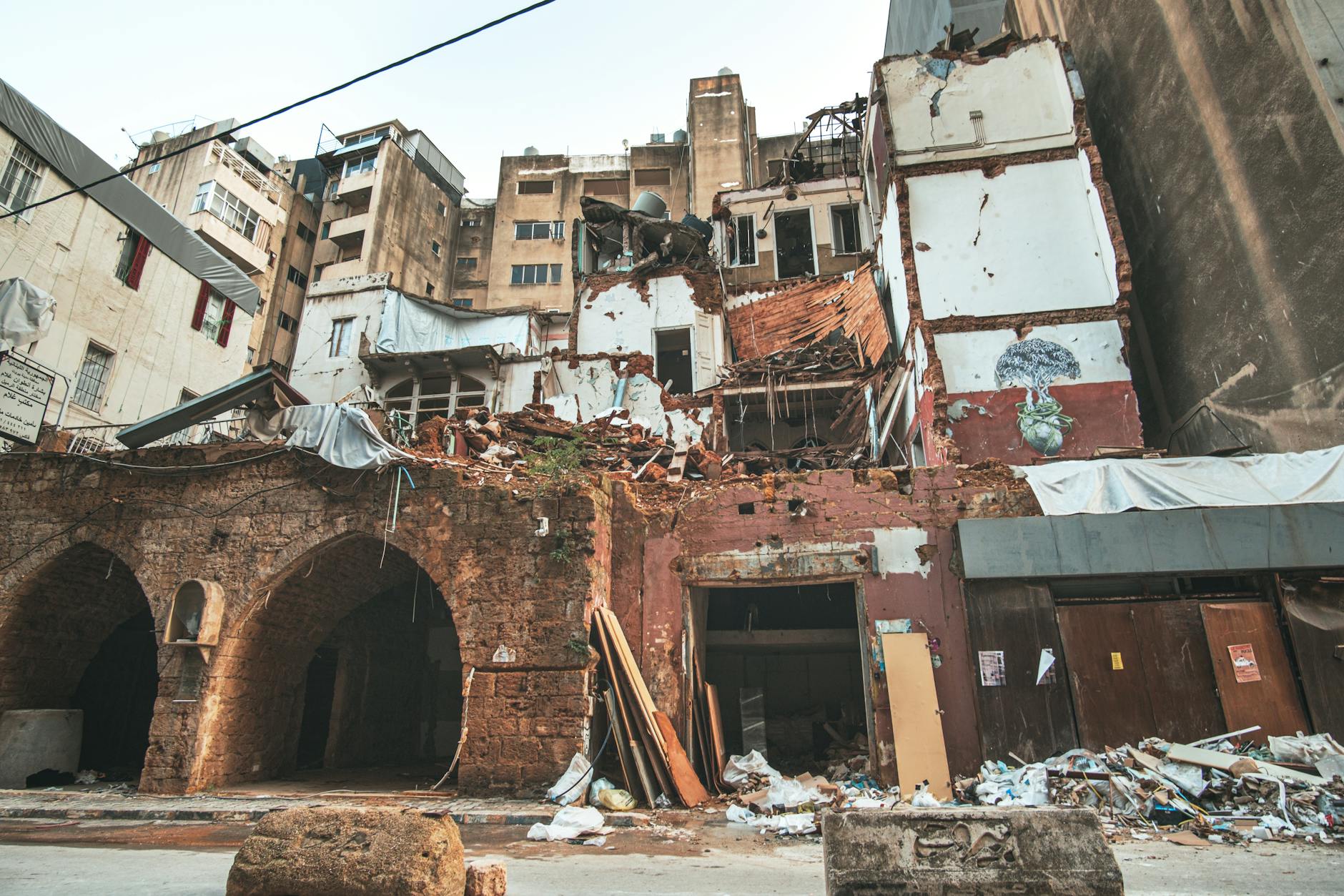
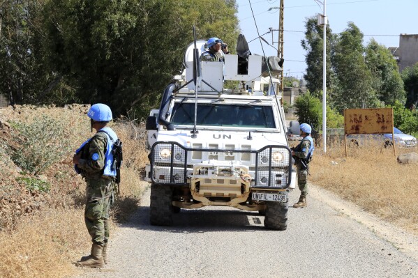
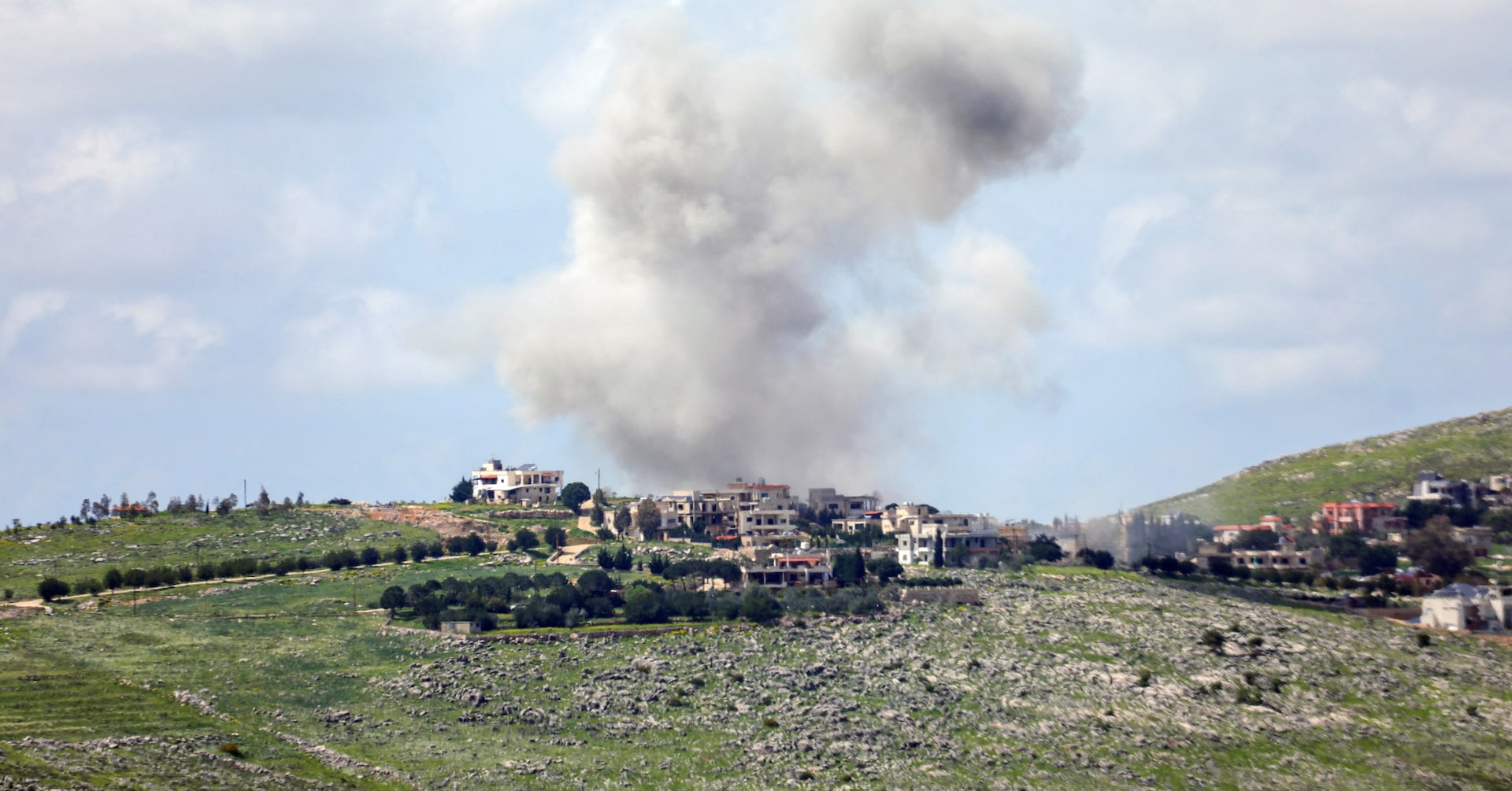
Southern Lebanon offers the clearest example. Defence Minister Israel Katz said in March that Israeli forces would “control the remaining bridges and the security zone up to the Litani”, Reuters reported. A later Al-Monitor report on an Israeli military map said the planned buffer could run 5-10 km deep and cover about 8 per cent of Lebanese territory. Those are not minor tactical adjustments. They amount to an effort to redraw the military geography of the border in ways that are hard to unwind.
Syria’s inclusion in the FT’s 1,000 sq km total matters for the same reason. Israel has often treated each front as exceptional, with its own operational logic and its own clock. Once land under control is aggregated across three theatres, however, the pattern looks less like a series of isolated security responses and more like a regional method: hold ground, widen standoff distance and accept the political burden that comes with permanence.
Measured against Israel’s 1949 borders, the FT estimate comes to about 5 per cent. That is not vast in absolute terms, but it is large enough to make the occupation question unavoidable in diplomatic terms.
Militarily, the policy carries real costs. The broader the footprint, the more soldiers, supply lines and local choke points have to be protected. Holding bridges up to the Litani — or controlling more than half of Gaza after a ceasefire — is different from striking and leaving. Buffer zones can reduce near-term infiltration risk. By the same logic, they create more fixed positions to defend, more civilians to displace, and more fronts where a temporary deployment starts to look like an occupation.
Diplomatic costs rise with the map
Diplomatic pressure is converging around the same question as the military reporting: how much control is Israel normalising. Volker Turk’s warning, reported by Al Jazeera, called on Israel to “prevent the commission of acts of genocide” in Gaza, a line that captured how legal and human-rights scrutiny is tightening as the campaign continues. On the Lebanese front, a Reuters reconstruction of the death of a Lebanese village showed how prolonged control and repeated operations can hollow out entire communities even when the global focus is fixed elsewhere.
The U.S.-Iran truce talks exposed the gap between diplomacy and facts on the ground. The Reuters report carried by Yahoo News described those talks even as Israel was consolidating control. Diplomacy was moving on one track; the territorial map was moving on another. A state that builds belts deep beyond its borders is shaping the terrain on which any later ceasefire would have to be negotiated.
For Netanyahu, the appeal of the strategy is plain. A belt inside Gaza, another in southern Lebanon and a further position across the Syrian front promise distance from hostile fire and a clearer physical barrier than paper deterrence ever offered. They also fit a domestic political logic in which visible control can be sold as proof that the state has restored security after the failures exposed by the war. Land is legible in a way promises are not.
Visibility, however, is now the strategy’s main liability. Once officials define success through depth, every new kilometre invites a larger argument about permanence. Foreign governments that tolerated cross-border operations as retaliation may be less willing to accept an expanding map with no clear off-ramp. Arab states weighing de-escalation, western allies pressing for restraint and international bodies focused on civilian harm are all responding to the same picture: a war that measures security by territory held rather than only threats neutralised.
The result is that Israel’s campaign is being judged on two clocks. On the short clock, deeper belts can be presented as an answer to immediate security failures. On the longer one, the policy risks binding Israel to a costly regional posture that is harder to defend diplomatically than militarily. The more the footprint across Gaza, Lebanon and Syria comes to define Netanyahu’s war strategy, the less this looks like a set of emergency positions and the more it looks like a new border doctrine with no settled end point. That ambiguity is becoming part of the strategy itself.
Yara Halabi
Foreign affairs correspondent covering the Middle East, the Gulf and US foreign policy. Reports from London.